101.6 km - Total so far 5,180.09 km - http://ridewithgps.com/trips/5848417
Day 61 - A new video was added.
We left Paudash at around 8:30 on route to our last campground near Griffith. We expected the route to be pretty much the same as the day before with lots of uphill and downhills and once again we were not disappointed. These darn little hills are so close together that there isn't much of a chance to take a break. We were told that Northern Ontario (Hwy 17 North of Lake Superior) was tougher than the Rockies but the folks who told us that might not have had the pleasure of riding Hwy 28 in Haliburton.
We stopped for a drink and a rest at a country store in McArthur's Mills. There were two young travellers from Quebec who upon seeing us said they had done the same thing as us when they cycled on Prince Edward Island last year. When we cycled the Cabot Trail the first time, our guide Jacob Racine told us he was next going to support a ride in PEI and that there is one hill to speak of in PEI. I just couldn't get over what I had just heard and you can see my reaction in the picture below. I think I am becoming a cyclo-touring snob (Hélène uses another word but I can't repeat it here!)
 |
| Smiling from the encounter with the two young Quebecois we met in the store |
 |
| McArthur's Falls rushing water |
 |
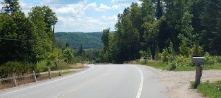
| The view from the top of one of the many hills |
 |
| Not just about hills but also about farmers working their fields |
 |
| The flower of the day |
 |
| A nice little climb, short and steep and you can see the top |
 |
| Nice little farm house |
 |
| View at the top of the 12% hill, it was well worth the effort |
We keep a list (well many lists as Hélène has lists for everything) of the most difficult hills we have climbed since our first cycling trip in Cape Breton in 2012. After cycling almost 5,200 km on this trip and climbing up such memorable features as Allison Pass, 10-Mile Hill out of Golden, the hill in Cochrane Alberta and that little 12% the other day, the most difficult hill we have ever climbed remains the hill at Ste Madeleine de la Rivière Madeleine , in Gaspésie. This hill remains the only one where we either had to push the bicycle to the top or needed a push to start climbing after a rest stop.
63.13 miles - Total so far 3,271.88 miles
Votre fleur du jour est l'épilobe, en anglais fireweed. C'est la fleur du Yukon.
ReplyDeletePauline